How Can We Help?
Importing DTM Data
When you import DTM data, TerraForm creates a new landscape actor to the specifications you input in the Landscape Settings and sets the scale so that your landscape is the same size as your source DTM in UE4. It moves your landscape so that its centre is at x=0, y=0, z=0 in Unreal’s coordinate system and then resamples the source DTM elevation data and copies it into the landscape.
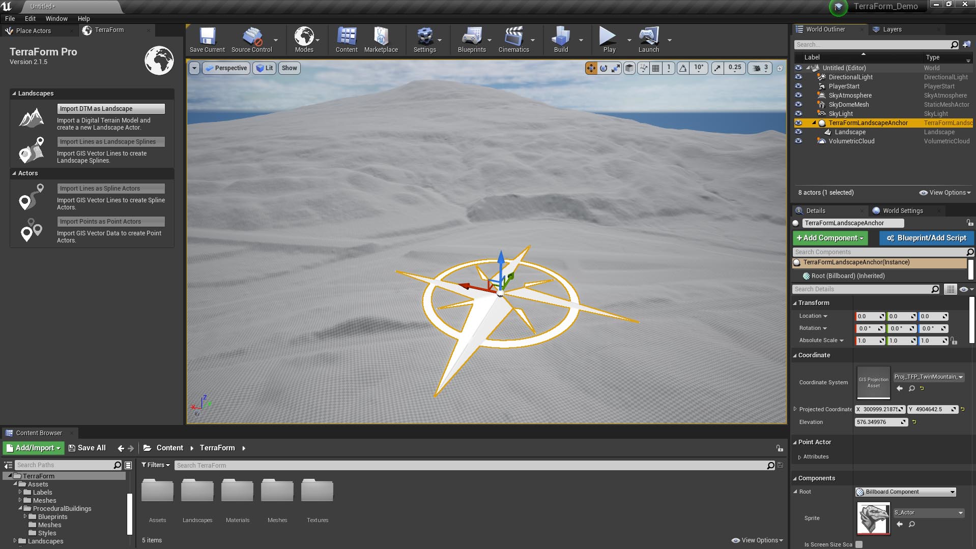
GIS Projection Asset
The projection information for your GIS data (projection, datum, scale, dimensions etc.) is retained in the TerraForm GIS Projection Asset, which is created each time you import a DTM file, and stored in a folder in the Assets Path. TerraForm reads the GIS Projection Asset when you import GIS vector data into your landscape.
TerraForm Landscape Anchor
TerraForm also creates a TerraForm Landscape Anchor that is used to link the GIS Projection Asset to the landscape and stores the origin of the landscape in the coordinates system (projection/datum) of the DTM data. The landscape is parented to the TerraForm Landscape Anchor during the import process and must remain so if you wish to import more GIS data.